Upper-lake field day · Rock Island · Walling
A Rock Island Day That Actually Starts at the Upper Lake
Rock Island is not an outlying waterfall to tack onto a Smithville itinerary. It is one of Center Hill Lake’s upper gateways. Give its lake shore, gorge, river history and nearby communities a day organized around the experience you came for.
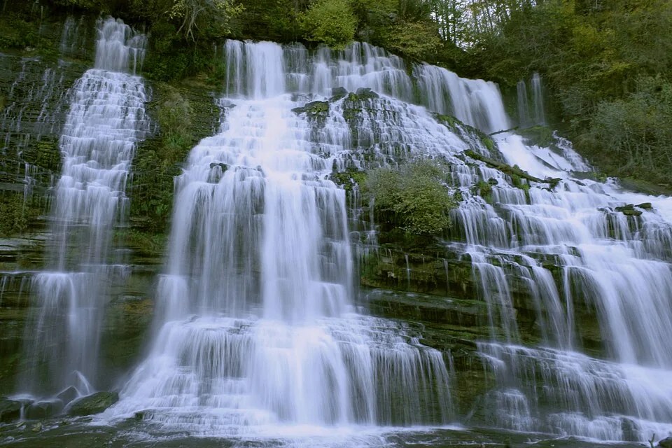
Rock Island State Park sits where the Caney Fork, Collins and Rocky river country meets the headwaters of Center Hill Lake. It offers the park’s natural sand beach and boating access on the lake as well as Great Falls and Twin Falls in the river and gorge setting. Those experiences look close on a regional map, but they require different entrances, footwear, equipment and judgment. Locate this end of the lake first, then pick the actual park stop.
Set the day’s purpose before leaving
For a swim-and-picnic day, navigate to the park’s lake beach and verify its current status. For waterfalls, use the developed Great Falls and Twin Falls viewing areas and heed every closure. For boating, confirm the exact launch and water level with the park. Do not use a generic “Rock Island State Park” pin as the whole plan.
A waterfall overlook, a lake beach and a boat ramp are three different promises, even when they share the same park name.
01
Reservoir · Great Falls Lake · Gorge
First decide which water you mean
The name Rock Island can refer to several water experiences. Center Hill Lake reaches the park’s upper end and offers a lake beach and boating access. Great Falls Lake is associated with the upstream dam. The moving water and falls below the dam and powerhouse belong to a changing gorge, not a calm extension of the beach. The Tennessee Wildlife Resources Agency explicitly identifies the upper Center Hill reservoir from the Rock Island State Park boat ramp toward Great Falls Dam in its fishing rules.
The distinction is practical, not pedantic. A family carrying towels needs the beach. A photographer may need a developed overlook. A boater needs a launch that works at the current pool level. A visitor who follows the wrong pin may end up at a beautiful place that cannot do the job.
Check the park’s current areas and alerts · Read TWRA’s reservoir information
02
One anchor · One complement · A real return
My version of a full upper-lake day
- Morning: Choose Great Falls or Twin Falls as the primary overlook. Navigate to the named area, read the posted warnings and spend time there instead of racing through both.
- Midday: If conditions, access and the group’s energy allow, see the second developed viewpoint. Otherwise give the lake beach, picnic area or a gentle park stop the middle of the day.
- Late afternoon: Select one community direction. Walling works for a deliberate nearby dinner when service is confirmed. McMinnville works when you want more town choices. Sparta is useful if your road home naturally goes that way.
- Return: Check the road back before dinner. If the group is tired or the weather changes, eat simply and end the day.
This is a structure, not a promise that every area will be open or suitable on every visit. From a stay already near Rock Island, you can start later and spend longer at the lake. From the Hurricane side, this is a destination day, not a quick waterfall errand.
03
Beach · Boat ramp · Current conditions
If your group came to swim or launch
The park’s natural sand beach is the straightforward lake-swimming choice here. It should not be confused with the gorge or the water immediately below the powerhouse. Tennessee State Parks warns that releases and dangerous currents can make parts of the gorge unsafe, and swimming or wading is prohibited in posted downstream areas. Obey the signs even if the water appears quiet.
For a trailer, call or check the park about the ramp’s present usability. Pool levels, repairs and closures change the answer. Bring a shoreline plan that still works if launching is unavailable. For paddling, do not infer that a calm beach makes a gorge route appropriate for casual paddlers.
Open park directions · Verify beach, ramp and gorge guidance · Read the trailer checklist
04
Great Falls · Twin Falls · Falls City Mill
The falls tell two different water stories
Great Falls is the horseshoe-shaped fall below TVA’s Great Falls Dam. Its visible flow changes with discharge. Above it, the remains of the Falls City Cotton Mill recall a period when the river powered industry; the mill operated from 1892 to 1902, according to Tennessee State Parks. That is a better reason to pause than merely collecting another waterfall photograph.
Twin Falls behaves differently. Water from the Collins River emerges through limestone bluffs into the Caney Fork gorge. Look at where the water appears: the rock and the diverted river system are part of the story. These are two separate viewing areas, and the park’s map is more useful than a single search pin. The park description and map provide the source details; the geology guide helps explain the limestone landscape.
05
Blue Hole · Sandbar launch · Regulations
Fishing and the upper reservoir
The park identifies the Blue Hole on Center Hill Lake near its shore as important walleye spawning habitat, just upstream of the Sandbar launch. That is a very different reason to visit from the beach or overlooks. The upper Caney Fork has a seasonal walleye regulation from the Rock Island ramp toward Great Falls Dam; check the current TWRA rules before choosing tackle or keeping fish. A valid Tennessee fishing license is required.
The park advises calling about boat-ramp availability when lake levels are low. Even an experienced angler should settle the launch question before towing to the park. Check TWRA’s Center Hill page and the angler’s guide.
06
Walling · Sparta · McMinnville
The meal should belong to your exit road
Walling is close enough to belong to this outing, but a named restaurant is an evening commitment, not a guaranteed walk-in meal. Foglight Foodhouse is worth considering if its current service and reservation situation fit. McMinnville gives more choices for a town finish; Sparta may be the natural direction for another base. Use the dining chooser to match the meal to your exit route and budget.
I would not automatically add Burgess Falls, Cumberland Caverns and a Cookeville dinner. Each can be excellent; together they turn this place into a series of parking lots. Give this upper-lake landscape enough time to become more than a stop between other stops.
07
Conditions decide
The change-of-plan rule
If mobility is the limiting factor, choose a specific developed viewpoint and confirm its current parking-to-view path with the park. If the lake is the priority, cut the second waterfall. If a storm or release closes the intended gorge area, the beach or town may still make a worthwhile day only if their own conditions are suitable. A changed plan is better than crossing a barrier.
The park says swimming or wading downstream of the powerhouse is prohibited at all times, regardless of release. Gorge closures can change quickly. Check the park’s current alerts and TVA Great Falls information, then obey signs on site. See the field map · Compare access at the falls · Explore another shore on another day