Understand the Lake · Roads · Communities
Center Hill Lake by Water and Community
From the dam at Lancaster to the upper water at Rock Island, Center Hill crosses several counties and a great many winding roads. Here is how I think about its distinct shores, access points and nearby towns before choosing where to stay or what to do.

Center Hill is a long, branching reservoir in the old Caney Fork valley, with coves following tributaries and ridges keeping roads apart. The U.S. Army Corps of Engineers describes its recreation area across DeKalb, Putnam, White and Warren counties. If you know only the Smithville and Hurricane shore, you know an important part of Center Hill, but not its whole shape.
See the problem on the map
The water connects places the road cannot.
Use the official map to understand the shape. Then use my field map when you are ready to go somewhere.

Use the map for orientation, then look up the actual entrance you intend to use. A road to one marina may not take you conveniently to the public ramp across the arm. A view of water from a cabin is not a path to it. The lake access guide sorts those promises out.
Do not ask only how close a place is to the lake. Ask which part of the lake it can actually reach.
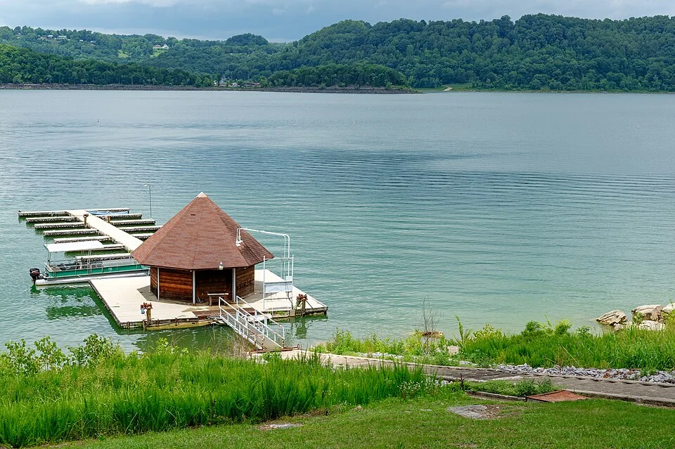

01
The governing idea
A boat map and a road map tell different stories
From the water, a point across the cove may be minutes away. By car, that same trip can mean climbing out of the hollow, following a ridge, finding the right bridge and coming back down another road. The blue gap looks small because the difficult part is the land around it.
I check the exact driving route to the exact ramp, marina, trailhead or restaurant. “Near the lake” is a regional description. It is not a travel time. On the water, wind, traffic, daylight, fuel and the return route matter too.
The simplest mental map runs from the dam and lower lake through the middle reaches near Hurricane and Smithville, out the southern arms, and up toward Rock Island. Those are planning areas, not official boundaries. The lake does not stop at the places most often photographed.
02
Center Hill Dam · Edgar Evins · Holmes Creek
The dam, Lancaster and the lower lake
At the lower end, Center Hill Dam makes the rest of the map readable. The reservoir is above the dam. The Caney Fork below it is the tailwater, a different river outing shaped by dam releases. Long Branch and Buffalo Valley are associated with that downstream river; do not mistake a trout-fishing or paddle plan there for a lake launch.
Lancaster, Center Hill Marina and the Holmes Creek/Hidden Harbor side give the lower lake its own approach. Edgar Evins State Park belongs in this picture too, with park trails, launch access and a marina. A park entrance, a marina reservation and a particular boat ramp are three separate destinations. Check which one you selected before following the last turn.
This side makes sense for a dam-oriented day, state-park stay or marina departure. Start with the Corps’ Center Hill recreation page and Edgar Evins park page for current facilities.
03
Hurricane Bridge · Floating Mill · Puckett Point
Hurricane, Silver Point and the middle-lake crossing
Coming down from Interstate 40 through Silver Point, you encounter one of the most recognizable ways into Center Hill country. Hurricane Marina is a natural anchor for a boat or marina meal; Floating Mill is a Corps campground and day-use area nearby. Hurricane Bridge is a useful orientation mark, not a guarantee that every place bearing “Hurricane” shares one entrance.
Floating Mill Day Use has a designated swim beach. A ramp such as Puckett Point serves launching and shoreline orientation; it is not a designated swimming beach. The Corps says swimming is prohibited at launching ramps, marinas, mooring points and public docks. If a family asks for a beach, I send them to a confirmed swim area, not whichever ramp is closest.
The Little Lake House sits in a wooded residential pocket near Puckett Point public boat ramp on the broader Hurricane side. That is one useful reference for guests, but only one pocket of the lake. Hurricane Marina is a separate drive and Smithville handles many practical needs. The Puckett Point field note explains the immediate setting.
04
Town errands · Ragland Bottom · Western approaches
Smithville is a service center, not a single shoreline
Smithville solves ordinary trip problems for many stays: groceries, fuel, a meal, supplies and the item somebody forgot. Downtown can be part of the day instead of merely an errand. Yet “Smithville” also appears on rural addresses spread across different roads. Two properties with that mailing city may have entirely different routes to their nearest water.
Ragland Bottom, east of town on the Highway 70 side, is a Corps recreation area with a day-use swim beach and launching facilities. It gives a family seeking sand and a boater seeking a ramp two distinct reasons to head there. Confirm the current season, fee and facility status before setting out. The town center itself is not the access point.
I use Smithville to plan food and supplies, then name the actual shore for a water day. The dining chooser includes modest meals and quick stops as well as destination dinners, starting with the corridor you are already on.
05
Southern lake arms · Marina approaches
Sligo and Pates Ford deserve their own day on the map
The southern shore does not become an extension of Hurricane simply because the water connects. Sligo, Four Seasons and Pates Ford sit along different arms and road approaches. Their marina names are useful landmarks for boaters and for choosing a home base, but a slip, fuel dock, launch arrangement or restaurant is a specific service to verify with the operator.
Pick the marina or public access you will actually use, save its address and look at the road back before adding dinner. If the day points toward McMinnville or Cumberland Caverns, that can be a sensible inland continuation; it does not make every southern shore a short drive from town. Use the new southern-arms field guide to choose the approach, then read the marina and rental guide for boat-day procedures.
06
Putnam County · Falling Water River arm · Regional services
Baxter, Cookeville Boat Dock and the eastern reaches
Cookeville Boat Dock names a real lake approach on the eastern side. It does not mean downtown Cookeville is on the shore. Baxter can be a gateway from Interstate 40, while Cookeville supplies the region’s broadest range of shopping, food and services. Those towns are valuable precisely because they have different jobs.
The Falling Water River arm leads toward Burgess Falls country. The waterfall park has its own trail access and rules; do not treat a point on the lake or a boat dock as a shortcut into the park. Plan a waterfall visit from the park’s current directions and alerts. A Cookeville meal may fit when your road route already runs north; it is less appealing as an automatic addition to a Smithville-side lake day.
The field map lets you compare road approaches to Cookeville Boat Dock, Burgess Falls and your meal instead of trusting the small distances between pins.
07
White and Warren counties · Headwaters
Rock Island, Walling and the upper water are Center Hill too
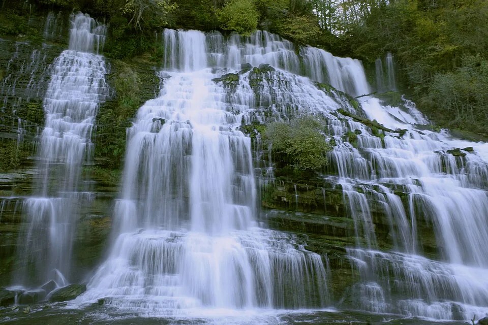
At the upper end, the river character becomes harder to ignore. Rock Island State Park sits around the Caney Fork, Collins and Rocky river country at the headwaters of Center Hill Lake. The park has lake access and a natural sand beach; its waterfalls and gorge are a separate, dynamic setting. Water releases and posted closures there deserve attention. A pretty falls photograph is not permission to enter a gorge or swim wherever water is visible.
Walling and Sparta make sense as community anchors for this side; McMinnville can fit a Warren County day. They should not disappear from a Center Hill guide merely because Smithville is a more common tourist base. Nor are they interchangeable with a Hurricane or Lancaster itinerary. Use Tony’s upper-lake day to build the outing, then check Rock Island State Park’s current guidance for the exact area.
08
Beach · Ramp · Marina · River
Match the access to the outing
For swimming, look for a designated area, its season and rules. The Corps lists Ragland Bottom Day Use and Floating Mill Day Use as public swim areas, plus the Floating Mill campground beach for registered campers. For launching, identify the ramp and check water level, parking and current access. For a rental or slip, call the marina about that service. For the Caney Fork below the dam, check release information and river access rather than lake conditions alone.
A peaceful overlook cannot launch a trailer; a busy launch lane is not a beach; and a private dock is not a public promise. The on-the-water guide and access explainer go deeper.
09
Cluster · Route · Margin
My rule is one side, one anchor
- Choose the day’s anchor: lake, waterfall, cave, town or event.
- Name the exact entrance and the road corridor that reaches it.
- Add only stops already along that route.
- Check hours, water conditions and the drive home before committing to dinner.
- Leave the opposite side of the region for another day.
You may collect fewer pins. You will spend far less of the weekend staring through a windshield, and each stop will have room to feel like a place instead of a deadline. If your home shore is Rock Island, Pates Ford, Holmes Creek or Ragland Bottom, begin there. The lake is not measured outward from my favorite address.
Understand the Lake series
Keep learning.
- Shape
- Anatomy of the Lake
- Water
- How the Lake Works
- Field
- How to Read the Lake
- Place
- Water & Community