Local history · DeKalb County · Caney Fork Valley
The Land Before the Lake
Center Hill Lake looks timeless. It is not. Beneath the recreation landscape is a history of river travel, farms, towns, war, forced change and communities that had to rebuild around a new shoreline.

Tony’s field rule
Don’t hunt for a drowned town. Learn to read a rearranged valley.
The lake is not a blank sheet laid over a lost world. Its coves, points and islands are the old terrain still doing its job. Read the land first; attach names only when the evidence earns them.
What the record can carry
Three levels of certainty. Keep them separate.
Federal project chronology
Construction began in 1942, paused during World War II, resumed in 1946, reached closure in November 1948, and impoundment followed in January 1949.
Use: dated federal records and engineering histories.Landform beneath water
Long coves track tributary valleys; points and islands are higher ground. That reading is geomorphology—not proof of who lived at a particular spot.
Use: topography plus historic and modern maps.A family or community story
Oral history can preserve what official records flatten. Attribute it. A named recollection is evidence; “people say” is where accuracy begins to leak.
Use: interviews, deeds, newspapers and family collections.Map laboratory
This is 1952—not “before.” That distinction matters.
The Tennessee highway map was issued only a few years after impoundment. It records an early reservoir landscape: water in place, altered road connections, and the surviving web of schools, churches, cemeteries, businesses and communities around it.
- Find the dark reservoir shape.Its branching geometry shows the river and tributary system.
- Trace a road until it breaks or bends.Then compare with a modern map. A change is a research question, not automatic proof of submergence.
- Read the symbols at the edge.Churches, schools and cemeteries show where community life continued beyond the pool.
 1952 DeKalb County highway map · Tennessee State Library & Archives
Five questions for the shoreline
Tap the question you should ask—not the legend you hope is true.
Tony’s answer
Where did the river run?
Start with the long, deep spine of the modern lake. That is the old Caney Fork corridor. The branching arms are flooded tributary valleys; the points between them are former ridges.
Watch with a purpose · 1 minute
The marker gives you the official frame. Your job is to notice what it leaves out.
This short USACE video explains the dam and powerhouse history at the site. Watch once for dates and engineering. Watch again and ask whose farms, roads and institutions are absent from the marker’s story.
- Write down one dated claim you can verify.
- Separate the dam’s purposes from its local consequences.
- Use the official account as a source—not the whole account.
U.S. Army Corps of Engineers Nashville District · 2015
A better rabbit hole
Follow one place all the way down.
Name it
Pick a road, cemetery, church, creek or family—not “the old town.”
Date it
Ask whether your map or memory describes before construction, during acquisition, or after impoundment.
Cross-check it
Make two independent sources agree before presenting the identification as fact.
Credit it
Record who supplied the map, image or story. Memory without attribution is easy to distort.
The lake created something extraordinary—but it did not arrive on empty land.
01
Caney Fork · Highland Rim · Human landscape
History did not begin with the dam
Long before the reservoir, the Caney Fork and its tributaries shaped movement, food, settlement and trade. Indigenous history across Middle Tennessee reaches thousands of years before European settlement; later Cherokee and other Native peoples used the wider region through changing periods of conflict, diplomacy and removal.
The surviving local record is uneven. Archaeological objects and nineteenth-century descriptions should not be used to reduce distinct Native peoples to the vague label “Mound Builders.” Responsible interpretation begins by admitting where the record is incomplete and by avoiding confident stories that the available evidence cannot support.
02
Liberty · Adam Dale · Early DeKalb County
Roads, mills and river trade
Adam Dale arrived from Maryland in 1797 and settled near what became Liberty. Dale and other early settlers cut a road from Nashville through difficult terrain, and a larger group of relatives and neighbors followed. Mills, forges and farms grew along the creeks.
Before highways, the river was infrastructure. Agricultural products and other goods moved through the Caney Fork system toward the Cumberland and wider markets. Water powered mills, connected isolated communities and periodically threatened them with flooding.
The Tennessee General Assembly formed DeKalb County in 1837 from parts of Cannon, Warren and White Counties. Smithville became the county seat; Liberty remained the older town.
03
Unionists · Confederates · Snow’s Hill
A county divided by civil war
DeKalb County was politically and militarily divided during the Civil War. John H. Savage served the Confederacy; his political rival William B. Stokes became a prominent Union officer. Their opposing paths reflected divisions that ran through local families and communities.
Fighting at Snow’s Hill near Liberty in 1863 and repeated military movement through the countryside brought seizure, hunger and instability to farms regardless of loyalty. The useful local story is not that the county “went one way.” It is that neighbors experienced the war from opposing sides and lived with the consequences afterward.
04
Dam construction · 1942–1948 · Caney Fork farms
The communities the water displaced
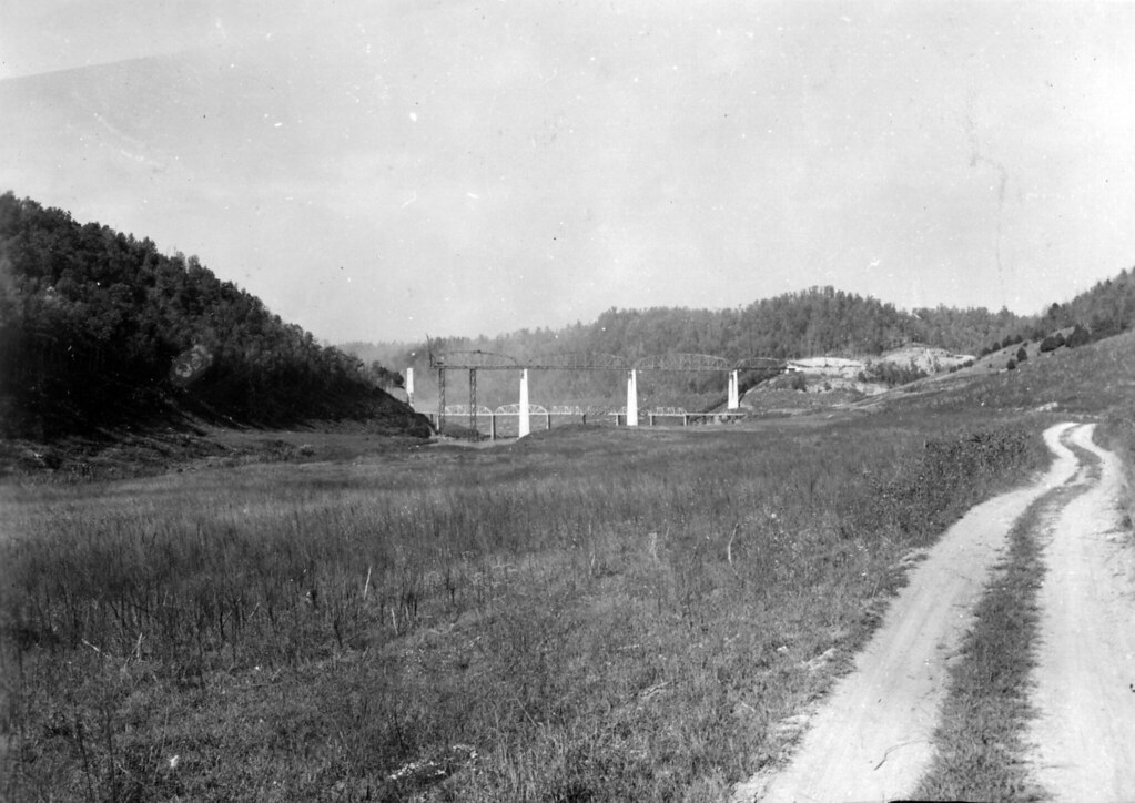
The U.S. Army Corps of Engineers began Center Hill Dam in 1942, suspended construction during World War II, resumed in 1946 and achieved closure in November 1948. Impoundment followed in January 1949.
The project brought flood control, hydroelectric power and a recreation economy that still defines the region. It also flooded parts of the Caney Fork area and forced farm families to move. Roads, fields, homeplaces and familiar relationships to the river were broken or redrawn.
The Center Hill Lake Information Center offers a pictorial history of dam construction. Call ahead to confirm current visitor access and hours.
05
Households · Churches · Work · Specific lives
People before labels
It is tempting to compress everyone who lived along the Caney Fork into a type called “mountain people.” That makes the story easier and the people less real. They were farm owners and tenants, mill workers, timber crews, merchants, ministers, teachers, children and elders. Some families had deep local roots; others arrived through the roads, river trade and changing work.
The surviving photographs matter because they restore specificity: a porch built for one household, a church serving one congregation, a barn adapted to one farm. The four field photographs on this page show structures and landscapes that survive in rural DeKalb County today. They are evidence of continuity, not substitutes for photographs of the particular families displaced by the reservoir.
Published local histories and family collections can carry that account further. Images reproduced in books remain copyrighted unless a rights holder or archive says otherwise; this guide will not detach them from their owners merely because they are historically valuable.
06
Agriculture · Tourism · New shoreline
What survived—and what changed
Agriculture did not disappear after the lake, but the county’s economy changed. Manufacturing, recreation and tourism joined farming as major sources of work. The shoreline attracted visitors while the older towns continued to carry institutions built before the reservoir existed.
Alexandria’s fairgrounds, Smithville’s courthouse square, rural churches and cemeteries, the Appalachian Center for Craft and the Fiddlers’ Jamboree now preserve different pieces of regional memory. They are not frozen remnants. They are places where Middle Tennessee continues to revise and perform its identity.
07
Music · Craft · Black history · Living communities
Keep following the local story
Continue with Appalachian craft, music and living traditions, the documented story of W.E.B. Du Bois in Middle Tennessee, the African American heritage route, and the history of the Free Hills Rosenwald School.
For a concise county chronology, read the Tennessee Encyclopedia’s DeKalb County history. It provides the backbone; local records and oral histories provide the detail.
Black history · Five distinct ways in
Continue with a different kind of experience.
Each guide has one job. Start with the format that fits your time, companions and questions; together they form a deeper collection without repeating the same trip.
Build a half-day or full-day itinerary →01Follow one life
W.E.B. Du Bois Heritage Tour
A source-led journey from Fisk to Alexandria, built around Du Bois’s own words and the strength of the surviving evidence.
Best forResearchers, educators & a full or DeKalb-focused driveOpen experience →02Investigate the evidenceBlack History Discovery Hunt
An interactive, observation-led challenge that turns reading, noticing and reflection into eight meaningful discoveries.
Best forFamilies, students & exploring from home or in the fieldOpen experience →03Drive the wider storyAfrican American Heritage Route
A practical regional route connecting schools, churches, cemeteries, museums and Black institution-building across multiple counties.
Best forFirst-time visitors choosing a responsible half-day routeOpen experience →04Go deep on one placeFree Hills Rosenwald School
A place-based history of a living Black community and the school its residents helped build under segregation.
Best forPreservation, education history & a Clay County excursionOpen experience →05Understand the groundThe Land Before the Lake
The broad context: communities, work, displacement and memory beneath today’s recreation landscape, with Black history in its regional setting.
Best forOrientation before any heritage tripYou are here